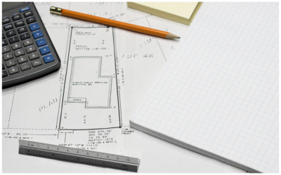
Obtaining professional land survey services is essential before land improvements can begin. Survey plans/deliverables will support and assist in the process.Depending on the land improvement, surveyors can optimize the deliverables needed. Land...
Obtaining professional land survey services is essential before land improvements can begin. Survey plans/deliverables will support and assist in the process.Depending on the land improvement, surveyors can optimize the deliverables needed. Land...

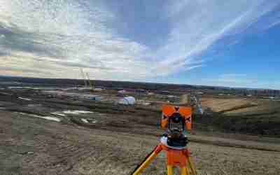
For thousands of years, there were not a lot of advancements in surveying; then, the computer age was born. Since the 1970s, survey technology has advanced rapidly, resulting in new tools, including GPS, Ground Penetrating Radar, Robotic Total...

Remote Sensing is a method that allows anyone to gather spatial data for a location or object without any direct physical contact. There are multiple examples of this, such as the sonar used by submarines, a satellite studying earth’s topography,...
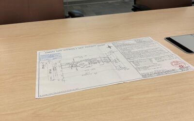
Whatever the reason for needing the Legal Land survey plan, below are some great ways to access the information in each province. Generally, land surveys are public records; accessing them can vary depending on each province throughout Canada. Most...
If you want to buy or sell a house or any property, you know that a lot of paperwork is involved, which can be overwhelming. When considering purchasing a new home, one of the most important things you need is a Real Property Report (RPR). Here's...

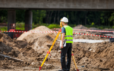
Did you know that land surveying is an area of discipline with a broad scope? For example, land surveys are performed for sectors like oil and gas, construction, renewables, land development, and infrastructure projects. Considering how broad the...

These Things Will Change the Way You Perceive Geomatic Services in Calgary With the increase of land and construction development in the Calgary area for the past decades, it is no wonder why geomatic services in Calgary are in high demand....
Real property reports (RPRs) play a critical role in real estate transactions. If you’ve experienced buying a house before, you’re probably familiar with the standard home inspections that help you get a closer look at a specific property. However,...
What Exactly is Land Surveying? When buying, selling, or developing land or property, it is important to work with professional land surveyors to review the land first. Land surveying is essentially a detailed review performed to map out the...

Land and property have long been worthwhile investment choices, but their hefty price tags make it critical that you think your decision through before purchasing any of them. Whether you plan to buy or sell property, you need to plan this...
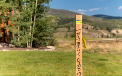
You often hear land surveying mentioned during the establishment of boundaries in Canada, whether it be when selling a home or developing a property. Knowing where your legal property boundaries is very important for a variety of reasons and to...

People call land surveyors for various reasons. Usually, surveyors come out to identify and locate boundaries, structures, and topographical features. You may also need these experts to secure a land purchase. What Tools do Land Surveyors use...